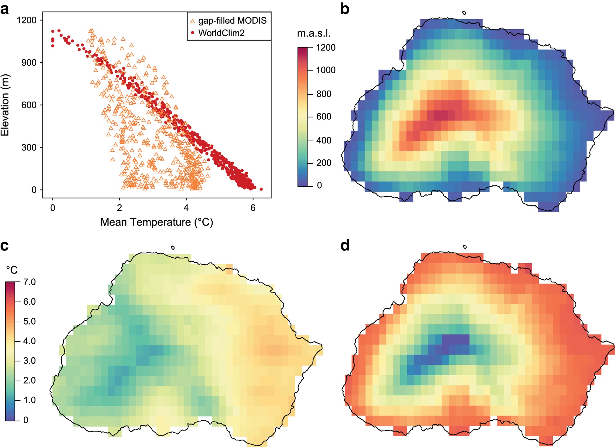
Figure 1: Collinearity of gap-filled MODIS land surface temperature data (this dataset) and WorldClim2 data with elevation on Marion Island.

(a) Bivariate plot comparison of the collinearity with elevation of the gap-filled MODIS land surface temperature data (this dataset, orange open triangles) and WorldClim2 data (red filled dots). (b) Elevation. (c) Mean temperatures of the gap-filled MODIS land surface temperature data (this dataset). (d) Mean temperatures of the WorldClim2 data. Marion Island (−46.908 °S, 37.7424 °E) used as an example.
